A current planning application for housing and the requirement for a transport assessment has highlighted how poor such documents are, particularly for cycling. The application in question is entitled “Land Between Resolution Way And Pembroke Way South Of Mayfield Road, Whitby“.
The original Transport Assessment, provided by the developer, was responded to by North Yorkshire Council asking “Section 3.4 cycling accessibility. The application documents provide information showing where the nearest, existing, recognised cycling routes are. It does not address how potential residents of the site would be able to access this route. The LHA require additional information to be included to demonstrate a safe access onto the cycling network.”
We consider it a positive step that NYC are asking for “safe access onto the cycling network”, and even the existence of a “cycling network”.
The response of the developer (via its consultant “Andrew Moseley Associates”) was as follows “Cyclists looking to utilise the nearby Cinder Track cycle route will be able to access via Anchorage Way to the east of the site. Anchorage way provides a link onto NYC PRoW 30.23/27/1, which provides southbound travel onto NYC PRoW 30.23/27/2, which runs eastbound and provides a connection the Cinder Track cycle route.“
We were somewhat puzzled by this, so decided to decipher what the consultants think is “safe access” for cycling. Here we map it out for them.
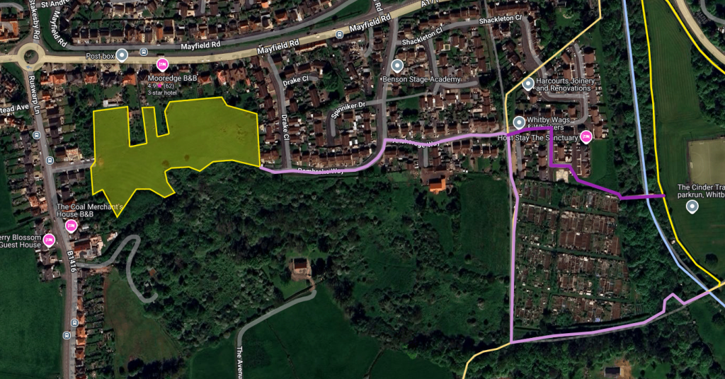
The housing development proposal is the yellow shaded area. The consultants recommend proceeding along Anchorage Way, and then down the light pink route, doing a sharp left turn below the Prospect Hill Allotments, and on to the Cinder Track. Anybody local would know the problems here.
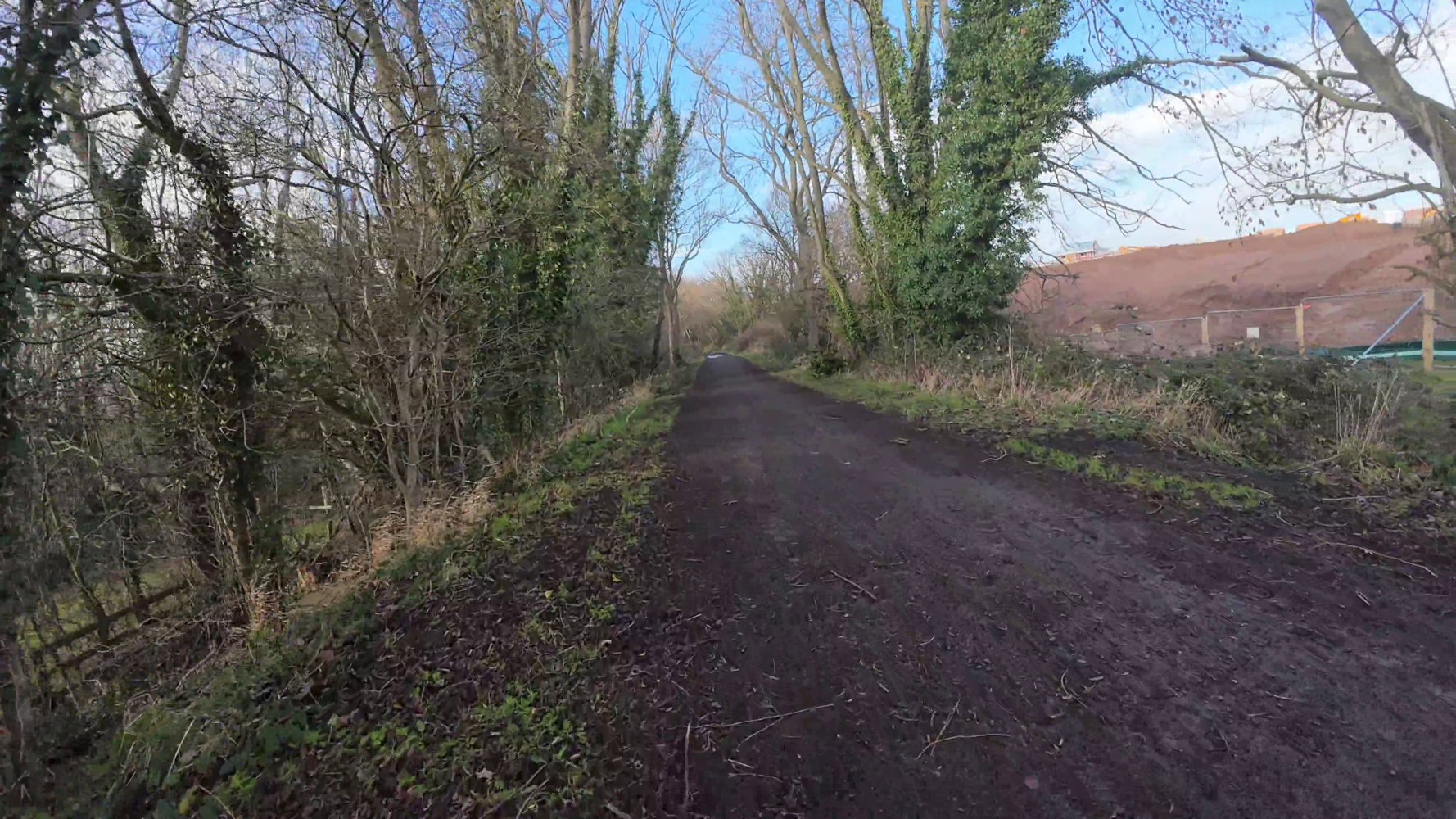
1. The first path (heading south) is on our site as the “Ruswarp Trod Path”. This is steep incline very narrow path that is somewhat slippy, and totally inappropriate for bikes.
2. The second path (heading east) is a very rough muddy surface that terminates at the top of a bank above the old Prospect Hill Line. Using a bike here would again be inappropriate.
3. There are then a set of steep steps down on to the Prospect Hill Line. With a bike? Would the cyclist be expected to do bunny hops down on their bike?
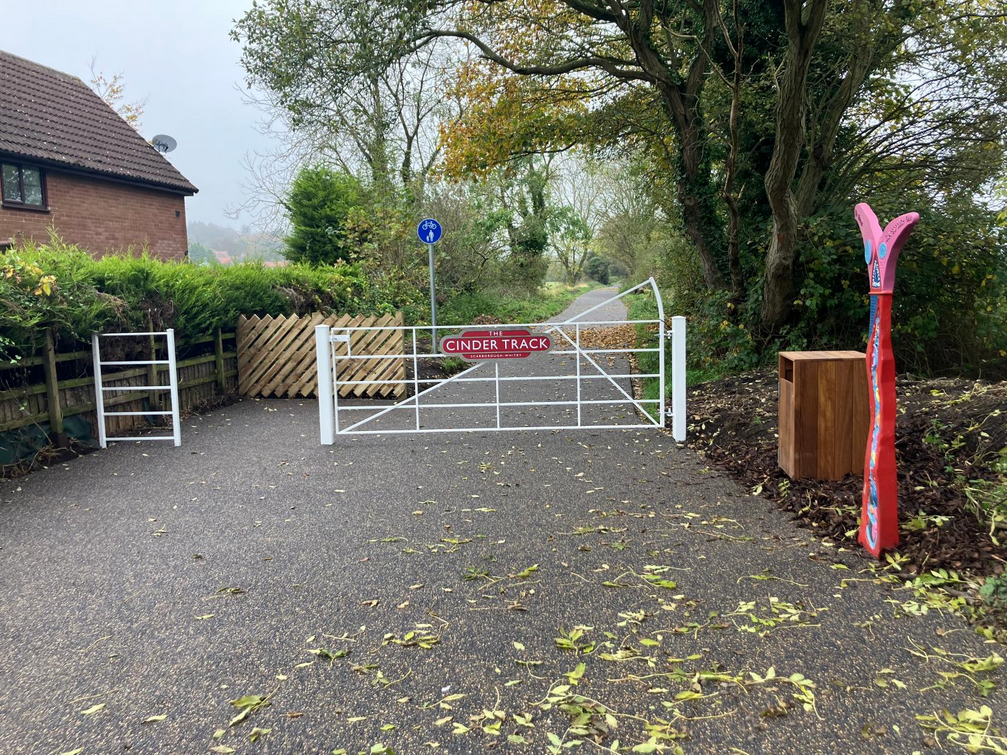
At that point the cyclist could cycle up the (often muddy) Prospect Hill Line and finally join the Cinder Track.
One can only assume that Andrew Moseley Associates have never visited this area, and also think that charging consultancy fees for providing such appallingly inaccurate advice is “acceptable”. Maybe our charity should start charging for advice on walking and cycling planning?
Our response to this particular planning document was as follows, where we also address the Transport Assessment’s treatment of walking.
This response is submitted on behalf of Whitby & Esk Valley Active Travel (registered charity 1206506).
Our response is solely with respect to the Transport Assessment report, and particularly to active travel (walking, wheeling, cycling and scooting) components, to guide any provision to properly cater for these requirements.
In terms of cycling, the report addendum statement of how cyclists would utilise the Cinder Track is synonymous of a report where the author of the report has never actually visited the area. The report proposes that a cyclist would utilise “NYC PRoW 30.23/27/1, which provides southbound travel onto NYC PRoW 30.23/27/2, which runs eastbound and provides a connection the Cinder Track cycle route”. Anybody familiar with this area would know that the aforementioned PROW is actually a narrow “Monks Trod” Path on a very steep slope – this is utterly unsuitable for cyclists, and indeed non compliant with current DfT standards for acceptable infrastructure for cycling. The latter PROW referred to is a very rough track which terminates in a series of steep steps down on to a disused rail line formerly known as the “Prospect Hill Line”. How would Andrew Moseley Associates propose that a cyclist get down these steps ? Bunny hops on their bike? Please contact us and we will WALK this route with you!
A better proposal to cater for cycling would be for this development to make an adequate S106 contribution to re-enable a disused bridge over the Cinder Track from close to Anchorage Way. This would then provide a new access point to the Cinder Track, and indeed provide a benefit to the community on the south side of Mayfield Road. There are more details of this link on
https://www.whitbyactivetravel.org.uk/project-mayfield-road-link/
In terms of walking, the Whitby LCWIP consultation process has already concluded that better prioritised crossing facilities over Mayfield Road are required. Given that the current active Local Plan aims to “prioritise sustainable modes of transport”, the proposals in the Transport Assessment are doing nothing to facilitate this end. The previous pedestrian surveys are somewhat of a misnomer since given the substantial problems in crossing Mayfield Road (no prioritised pedestrian crossing from 4-lane ends all the way down to Prospect Hill junction), many people simply do NOT walk (and subsequently do not appear in such surveys, leading to a flawed assessment).
A better proposal to cater for walking would be for this development to make an adequate S106 contribution to provide a prioritised pedestrian crossing over Mayfield Road.
How would you get to the Cinder Track from that part of the town if you were on a bike?