Project : Stakesby Vale
Status : Proposal
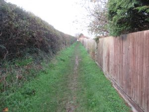
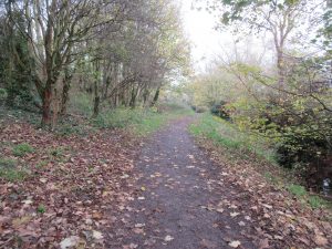
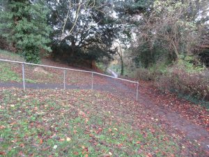
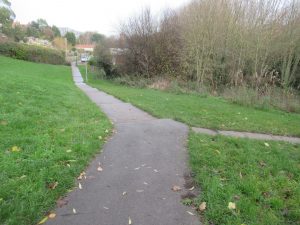
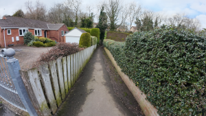
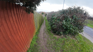
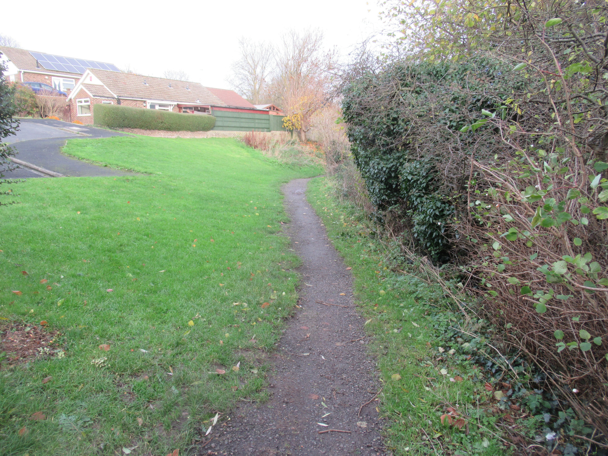
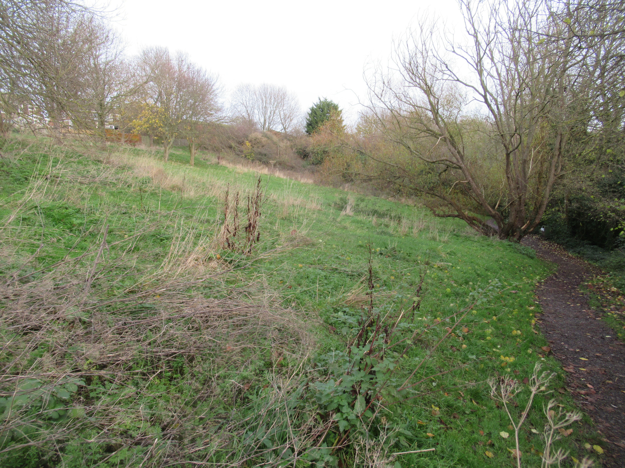
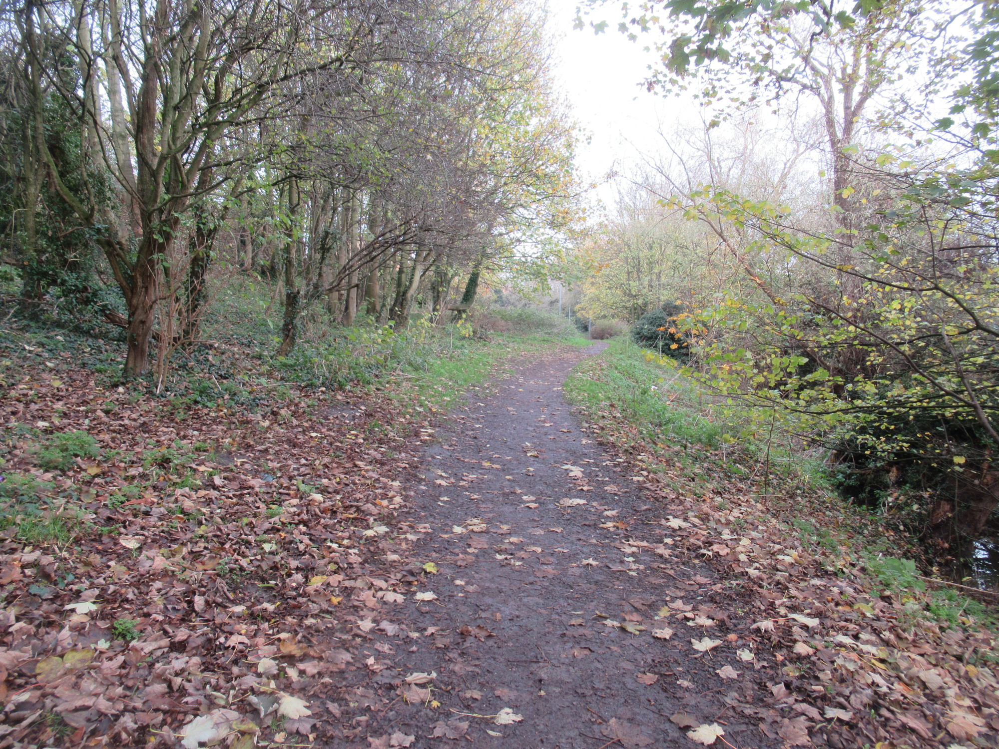
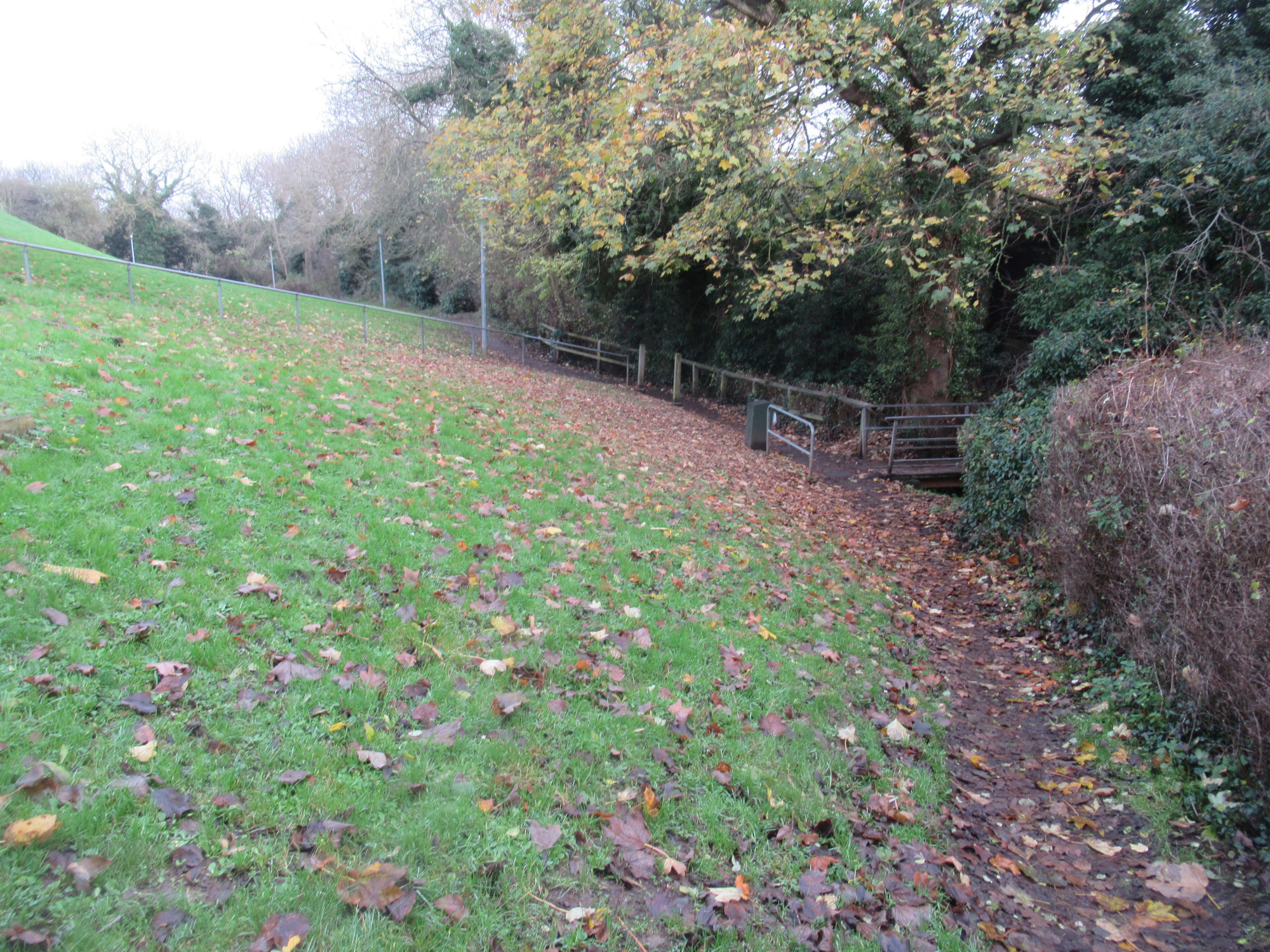
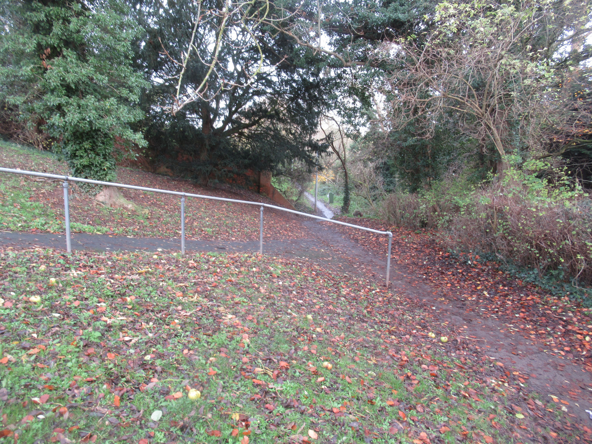
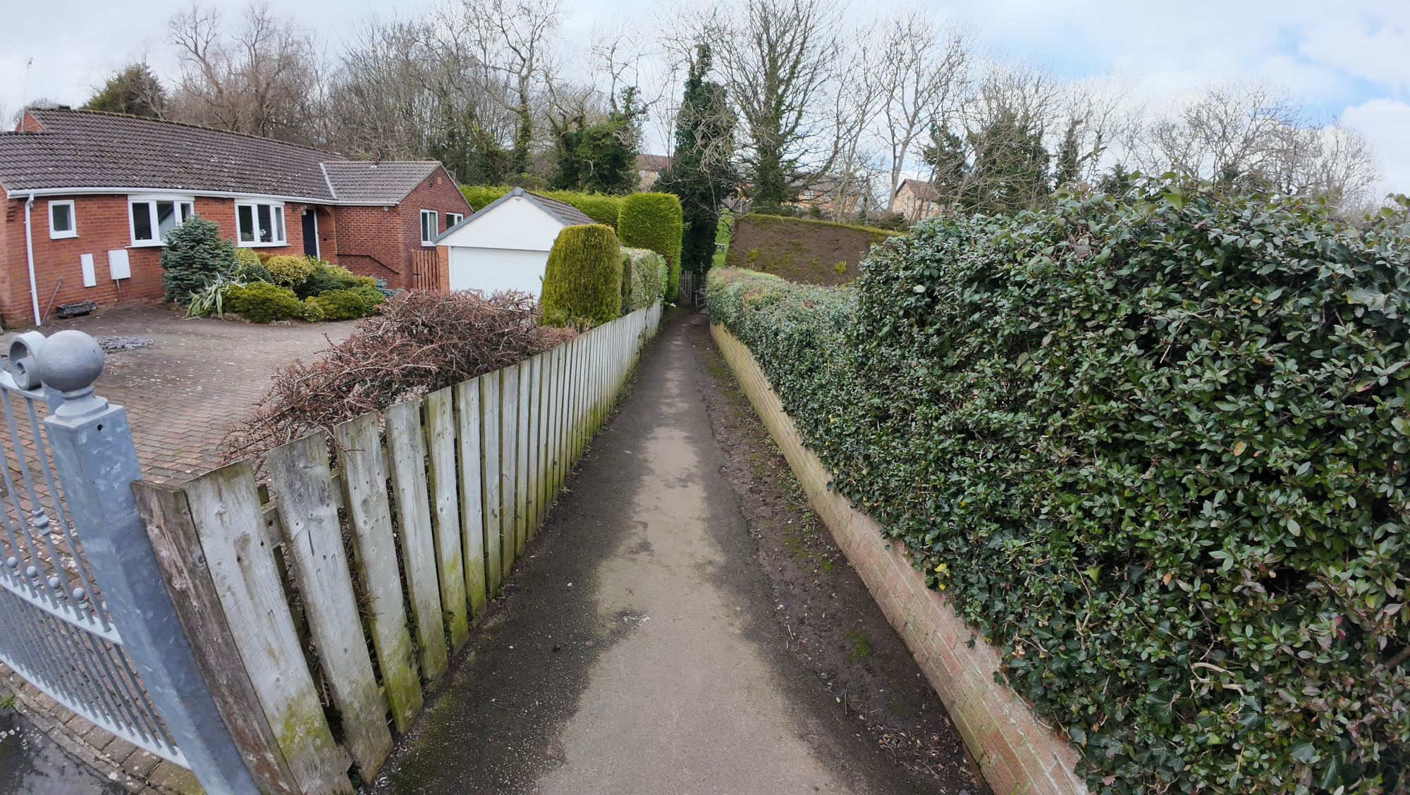
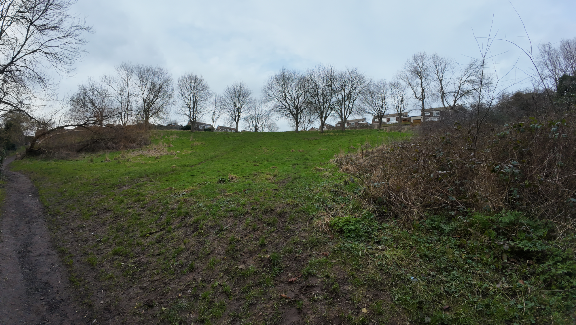
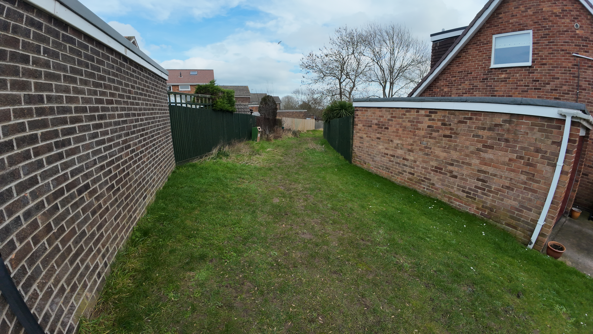
Stakesby Vale green space (often referred to as Bagdale Beck) provides natural open space for residents alongside a beck. It has had little maintenance / development since the 1970s. It connects High Stakesby Road (locally “Switchbacks”), with Stakesby Vale road and the start of the Cinder Track. The current path is an assortment of poor quality aging tarmac, decaying concrete, and small paving stones, and is covered in mud for many months of the year. The Stakesby Vale road end of the path would fail any disability access assessment with crumbling steps.
The path is currently suitable for : Walking, Scooting (with care – muddy, narrow).
This is part of Whitby LCWIP Corridor 4.
Route
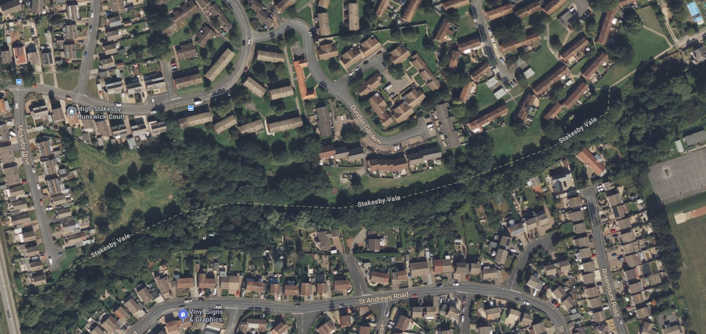
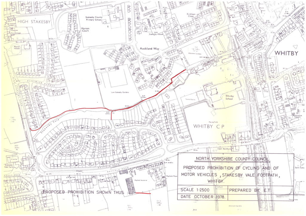
The green corridor and the existing “path” are shown below.
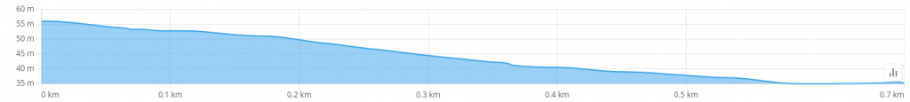
The gradient profile for the existing route is as follows


The Proposal
The proposal is to provide a new multi-user path through this area, providing for pedestrians, people on mobility devices, and people on bikes. The proposal for this path aligns with the adopted Whitby Active Travel Plan / LCWIP, providing the urban component of Corridor 4 (Whitby Town Centre to Whitby P&R).
In a survey that we conducted in Jan-Feb 2026 with school pupils, a path through this green corridor was often mentioned as something that would increase safety for walk/cycle to school.
Once complete this project would be suitable for : Walking, Cycling, Wheeling, Scooting.
Benefits of the Proposal
The proposed upgrade to the path through this area would provide the following benefits.
- Significantly increased pedestrian footfall through the area, and realisation of its potential as a prime radial route towards the town centre. Many people are currently put off due to the condition of the path and the unappealing nature of the space.
- Fully accessible and inclusive. Suitable for mobility scooters, wheelchairs, push chairs, and bicycles etc.
- Improved connectivity to Cinder Track. This path would provide a connecting path between Stakesby, St Andrews Road and Sneaton Castle estates towards the Cinder Track, and town centre, and hence significantly increasing the utilisation of the Cinder Track.
- Improved walk and cycle to Whitby School for all residential estates north of Mayfield Road, meaning fewer pupils having to walk alongside the busy Mayfield Road.
- Improved connection to nature for residents. This would allow other projects to be taken forward, such as introducing seats, a kids play area, or nature enhancements to be enjoyed by more people.
- Fully lit path. Upgraded lighting that stretches the full length of this green corridor.
Quantified Benefit : This has the potential to impact on up to 1300 dwellings adjacent (Stakesby estate has around 890 dwellings, Sneaton Castle has 236, St Andrews Road estate has 166), and then further out we have Castle Park with 500 dwellings. Using an average of 2.3 residents per dwelling, this equates to 3000 residents in adjacent communities, as well as 1000 residents further out. There is a substantial potential catchment for this route. To have such a route as an off road route would make a massive difference to the viability of active travel from residential areas towards Cinder Track and town centre.
Cost of the Proposal
Preliminary Design : To be defined by NYC
Construction : Dependent on Preliminary Design
Viability
Land Ownership : The whole of Stakesby Vale green space area is owned by North Yorkshire Council.
Other Issues : There is currently a Traffic Regulation Order (TRO) in place (confirmed by FOI) as below. This will need removing, and replacing with one solely for motor vehicles to enable provision of cycling. It would take the order of 18 months for application of a new TRO, so this would need to be borne in mind in terms of construction timing to have the new TRO ready.
Design
This work would be defined during the preliminary design phase, but hopefully the following gives some guidance.
The Path
A suitable path for this area would, most likely, be of a compacted gravel (UltiTrec) surface. Likely the best routing would be from Stakesby Vale road end as a shared path (3m wide), along to around point “3” on the map at the top of page, and then head diagonally north west to an entrance at the top of Mickleby Drive (this routing is to minimise the gradient, particularly for people on mobility devices and people on bicycles. From the point “3” it would also continue as a pedestrian-only path to the steps to High Stakesby Road. Connecting to the Stakesby Vale road end would be straightforward, though perhaps requiring the removal of the gate, and addition of a removal bollard. The path would be the order of 700m in length along the beck, with an additional maybe 100m up to Mickleby Drive, ideally 3m wide for the majority of the length.
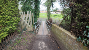
Bridge to Sunningdale Grove
The bridge across to Sunningdale Grove may need replacement with a wider bridge. The current design has a metal bar along the centre which can be slippy for cycling on when wet.
Ancilliary Work
An amount of fencing would be required alongside the beck where the path is within close proximity.
Lighting would be required as an integral part of the project, ideally providing an ecologically sound solution that is LED based, perhaps solar powered (but may not be possible due to the tree covered nature of some of the area), that is relatively inobtrusive for wildlife. It has to be mentioned that lighting already does exist from Stakesby Vale unadopted road through to the bridge at Sunningdale Grove.
Current Status
North Yorkshire Council have now initiated the design work for this project. This will encompass feasibility design, surveys of pedestrian / cyclist numbers, as well as concept / prelim design.